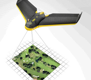
Mine surveys with drones


For several years now, a new surveying method has been on the rise – UAV surveying. With the help of drones, photos are captured, which in a complex computing process, which can take several hours, are evaluated photogrammetrically and provide accurate 3D data. This process is especially suitable and cost-efficient for surface mines, landfills and stockpiles.
Just a few years ago, surveying open mine areas covering 1 km² used to take about a day, but these can now be imaged in detail in less than two hours. From a precise point cloud with few centimetres point spacing, rectified, true-to-scale orthophotos showing the up-to-date mining status and 3D models for earthwork calculations can be generated. A 3D visualization can be made available to the mining company.
In the talk, the aerial vehicles necessary for this will be presented and the process with its advantages and disadvantages will be explained.
Dipl. Ing. Gustav Kuhn, Ing.-Büro für Markscheidewesen,
Vermessung und Bergbauplanung, Bernhardswald